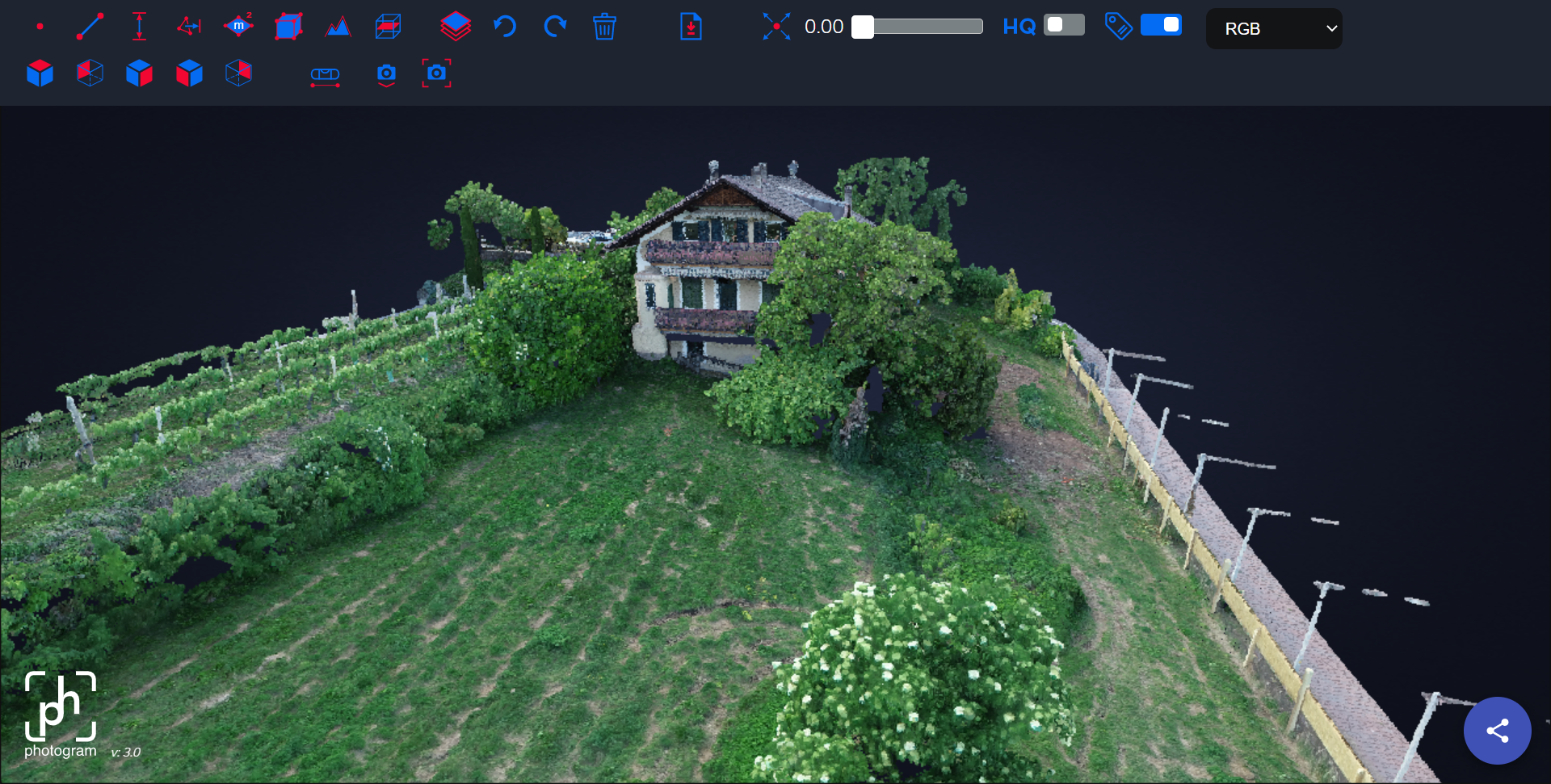
Webviewer
The Photogram Webviewer is an inhouse developed tool that allows you to view the Pointclouds that were generated from your Images/Videos/Laserscan-Files. It provides you with many tools that you can use to make measurements within your 3D Pointcloud.
Controls/Camera
Controls
- Orbit: The Camera will rotate around a point you choose. Double click to select a point and use your mouse to rotate around. Use the mouse wheel to zoom in and out.
- FPV: You can control the Camera with the WASD keys on you keyboard. Use you mouse to look around. Use Space to ascend and Shift to descend.
Camera
- View: The default camera.
- Ortho: An ortographic view. It doesn't matter how far away objects are from the camera. All objects are displayed in their actual size, without regard to the distance to the camera.

Tools
| Name | Description | Usage | Icon |
|---|---|---|---|
| Point | Set points and display their coordinates | Left Mouse Click - Right Mouse Click to cancel |  |
| Distance | Use this tool to display the distance between two points | " |  |
| 2D Area | Display the area of a 2D plane within the points you set | " |  |
| 3D Area | Display the area of a 3D surface withing the points you set | This Tool has two steps: Draw a border for your area with left clicks first and lock in the area with a right click. Add points to the area using left clicks and finalize the measurement with a right click. |  |
| Profile | Display the 2D profile (cross-section) along a line you set | Set points using left click and finalize the measurement with a right click. |  |
| Clip | Create your own visibility volume that you can resize and move around. Useful for cross-sections | Place the cube on the pointcloud and resize it by clicking and dragging the circles move it around by clicking and draggine the lines outside of the circles. Rotate it by clicking and dragging the circular lines on the outside. |  |
| Undo | Undos your last action | / |  |
| Redo | Redos your last action | / |  |
| Delete | Deletes every annotation/measurement on the screen | / |  |
| Download Measurements | Download you measurements/annotation as GeoJSON or DXF file | / |  |
| Point size Slider | Increases/Decreases the point size. This can be useful when dealing with a low quality pointcloud | Use the slider to change the point size |  |
| View | Quickly switch between views | / |  |
| Right Angle | Find the correct right angle | Draw a plane with three points then right click and measure along the normal vector. Right click to exit the tool. |  |
| HQ Slider | Increases pointcloud Quality | / |  |
| Facade Level Tool | Rotates the pointcloud so that the clicked point are on the same plane | Set points that should be level and click the tick symbol that appears next to the tool to finalize and rotate the pointcloud |  |
Viewing multiple Pointclouds
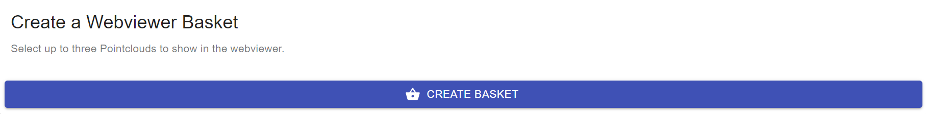
It is possible to view multiple pointclouds in the same Viewer by creating a Viewer Basket. Follow these steps to create a Viewer Basket:
- Go to the Project Dashboard
- Click on the first Pointcloud that you want to add to the Viewer Basket
- Click on Create a Webviewer Basket
- Go back to the Project Dashboard
- Click on the second Pointcloud that you want to add to the Viewer Basket
- Click on Add to Basket
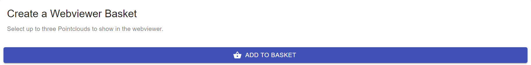
- Either repeat the process to add another Pointcloud or click on View to view your Webviewer Basket.